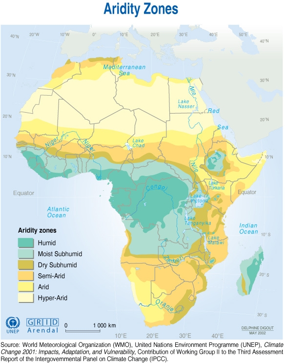
The
map on the right is a map of the World Meteorological Organization,
United Nations Environment Programme, Climate
Change (2001). It was prepared for the Third Assessment
Report of the Intergovernmental Panel on Climate
Change, and it provides the most accurate delineation
of arid and semi arid areas in Africa. It gives an overview of the African continent and it was used to delineate the arid and semi-arid areas in each of the case study countries of the project.
Click anywhere on the map to see it with its original size.
Click on a specific country to access its profile.
The maps below also give overviews of the areas that are unavailable and unsuitable, of the primary roads and railways, and of the populated areas. For an accurate analysis of the case study countries, please click on one of them on the map on the right.
The
following maps have been developed under the
COMPETE project by the University of KwaZulu-Natal
(UKZN), South Africa.
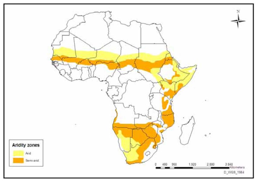
Arid
and semi-arid areas in African countries
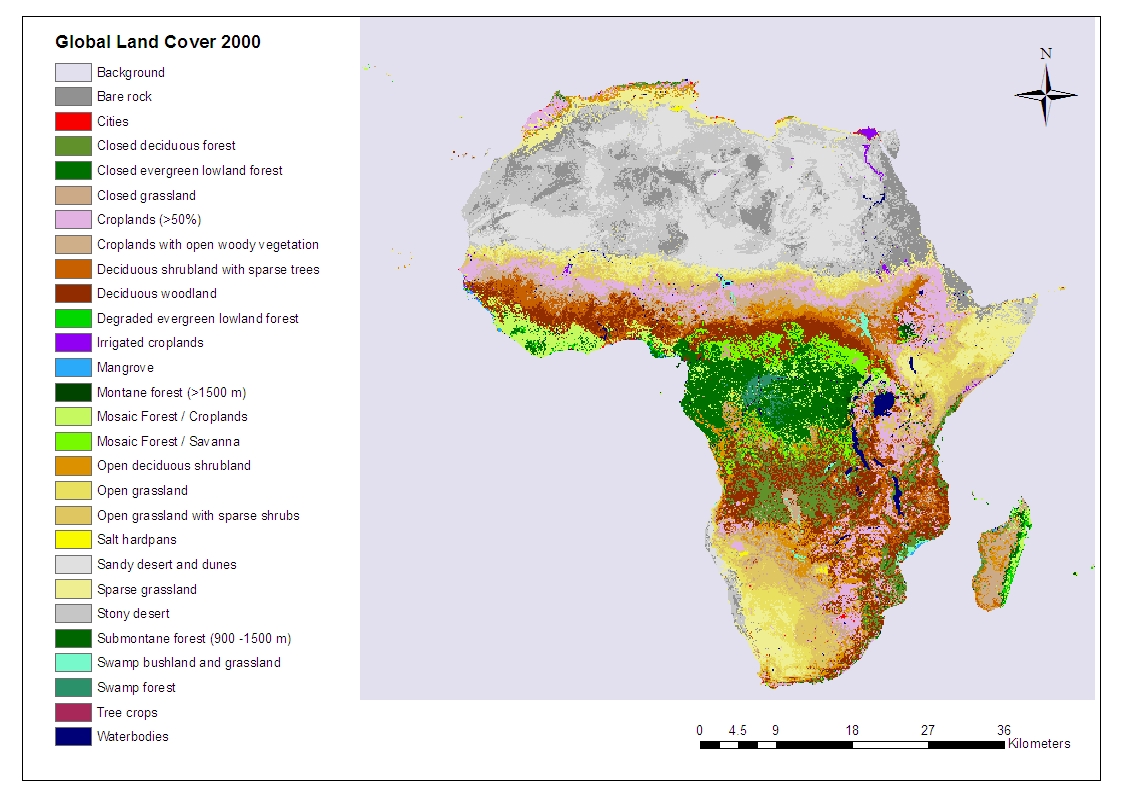
Spatial
extent of Global Land Covers in Africa
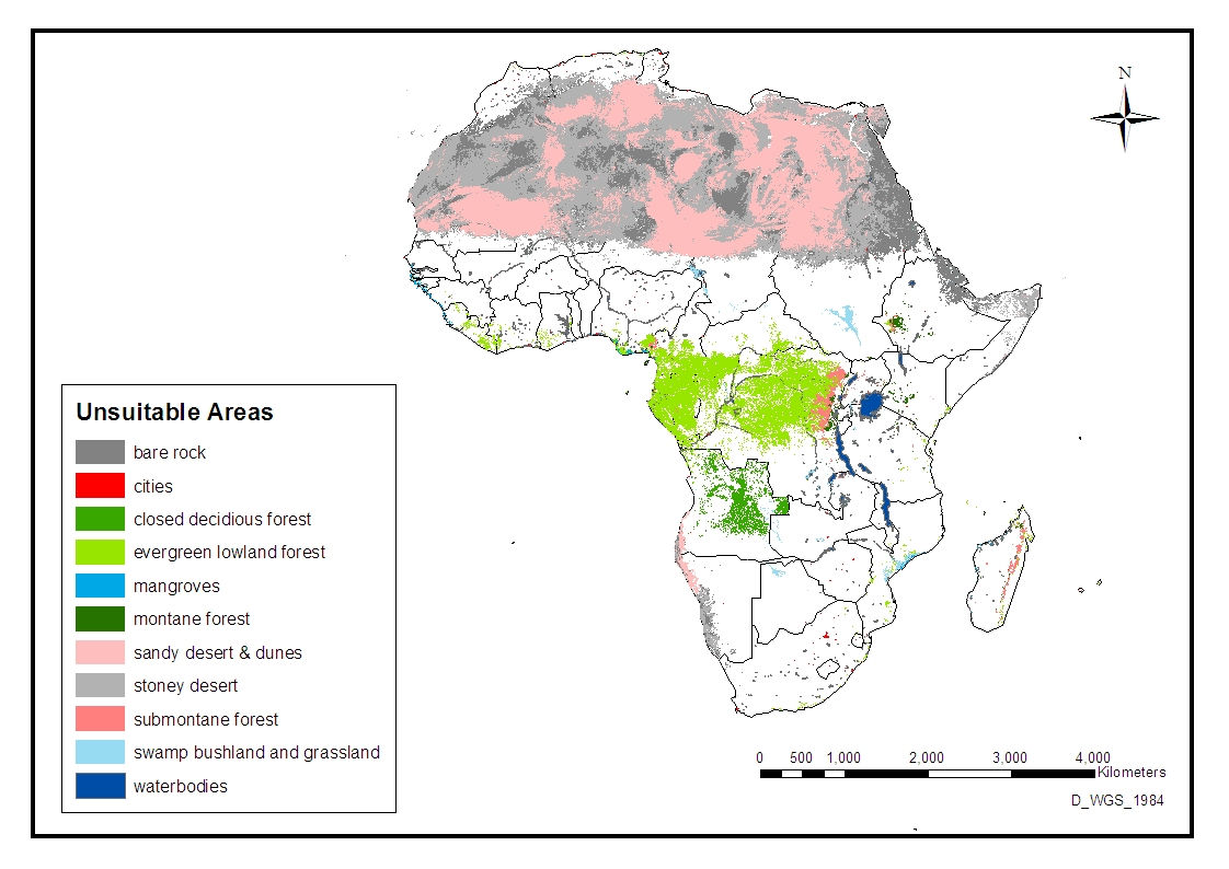
Land
covers unsuitable for bioenergy crops in Africa
Protected
areas unavailable for bioenergy crops
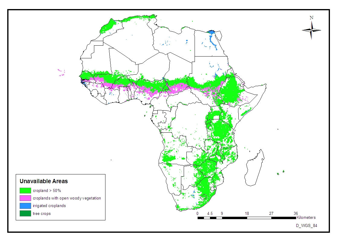
Areas
under food or cash crops unavailable for bioenergy
crops
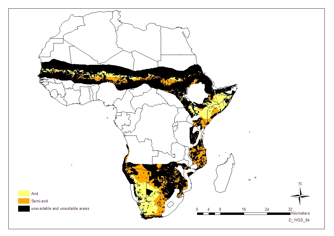
Areas
that are unsuitable and /or unavailable for
bioenergy crops in sub-
Sahara’s arid and semi-arid regions.
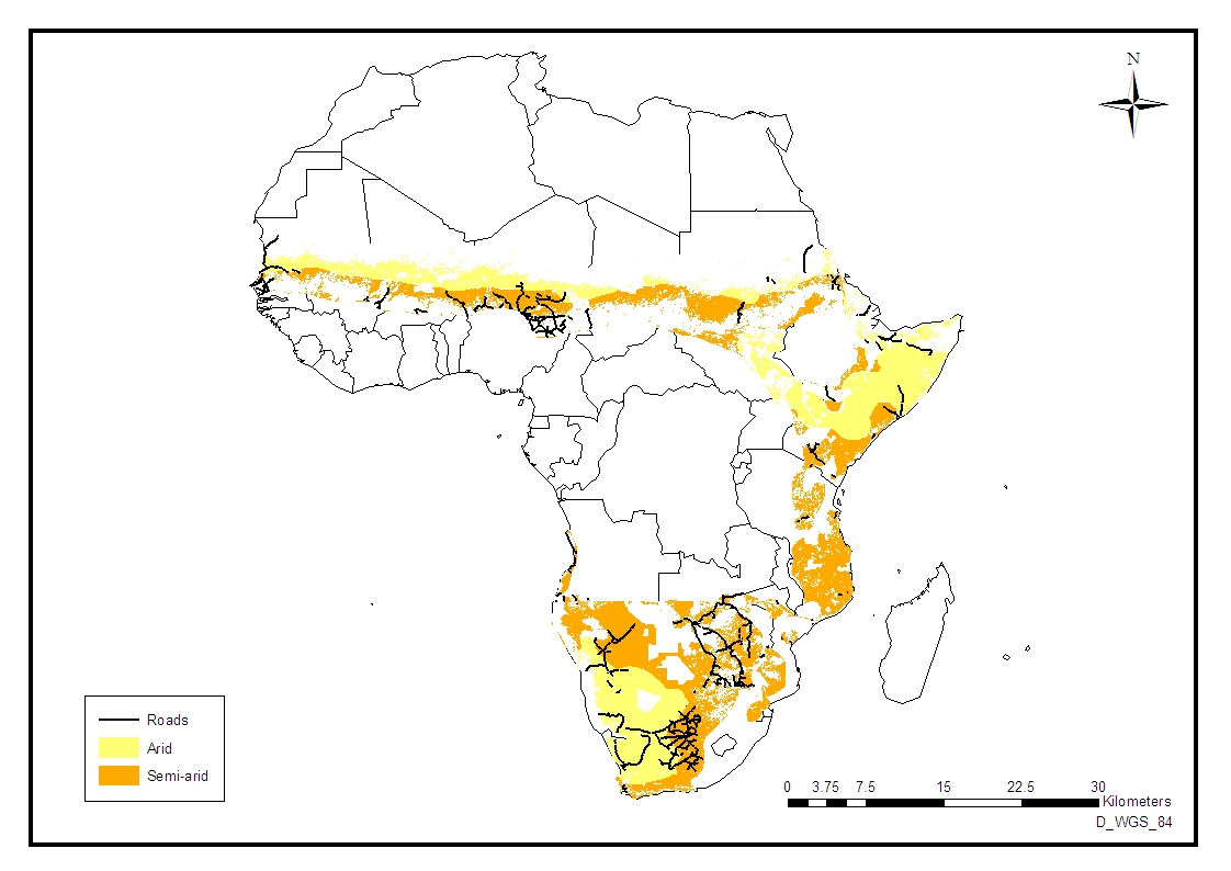
Primary
roads in arid and semi-arid sub-Saharan Africa
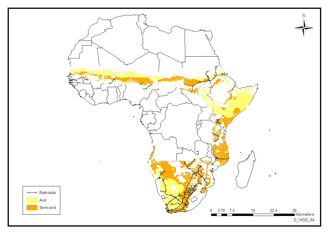
Railway
lines in arid and semi-arid sub-Saharan Africa
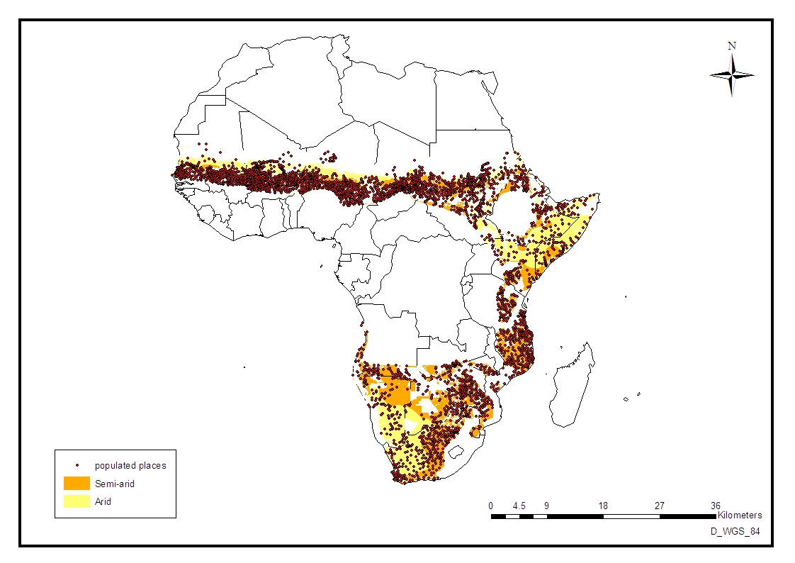
Populated
places in arid and semi-arid sub-Saharan Africa
.jpg)